RESEARCH SPOTLIGHT
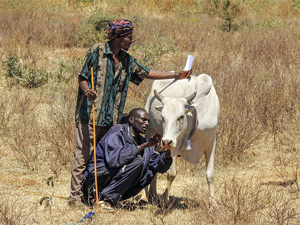
Pastoralists fit a GPS collar on one of their cows. Cornell researchers track the movement of herds to evaluate the effect of their interventions, and supply the information to governments and aid organizations to help in locating new watering spots. Image: Patrick Clark, USDA-ARS.
High tech helps rural herders
Space-age technology is coming to the aid of rural herders in Kenya, helping them deal with drought, climate change, civil unrest and land-use pressures that threaten food security in the region.
In a pilot project launched by Cornell researchers, satellite images and cell phone apps will combine to help governments and NGOs support their economy and perhaps guide them to find forage for their animals.
A team from the Dyson School of Applied Economics and Management in the College of Agriculture and Life Sciences and the Cornell Institute for Computational Sustainability have developed simple cell phone apps that the herders, called pastoralists, can use to report conditions at their grazing sites. "If we can use sophisticated technology to run Amazon[.com], we can use sophisticated technology to help people in Africa," says Carla Gomes, a professor of computer science with a joint appointment in the Dyson School and director of the Institute for Computational Sustainability. "We are trying to develop more accurate models of vegetation, rangeland and forage to guide policymakers." Gomes is principal investigator for the project, which is funded by the Atkinson Center for a Sustainable Future.
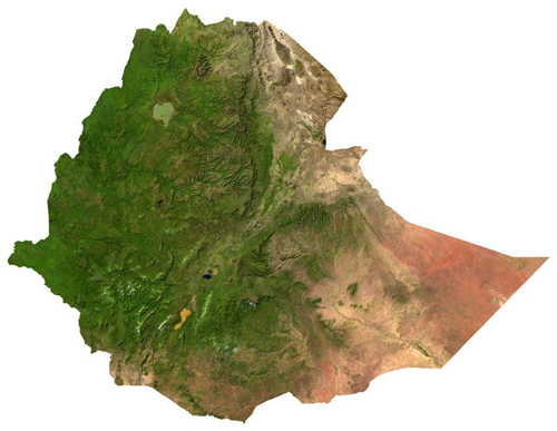
Satellite image mosaic of Ethiopia rendered in natural color. Green areas could be forest, shrubs, or grass and small plants. By combining images like this with crowdsourced data from the ground, computer analysis will be able to distinguish one type of vegetation from another. The satellite images also track drought and other disasters, enabling support agencies to respond. Image: Provided. See larger image
Pastoralists make their living – and help feed the population – by raising herds of cattle, sheep, goats and camels. They live a nomadic existence, moving from one patch of vegetation to another.
"Where the soils and rainfall are inadequate to grow crops, the only viable livelihood is raising livestock," explains Christopher Barrett, professor and director of the Dyson School. "Sixty percent of the economy is livestock products."
But that economy is "precarious," he adds; it is constantly threatened by drought and a lack of government support and recently aggravated by recurring violence. One of the many things needed is information, he says.
First responders, including governments and NGOs, as well as insurance underwriters, need timely and accurate reports of drought and other environmental disruptions. Reports from the ground will provide confirmation and better understanding of satellite data. "We now have some new capacity to fill in the gaps and create a more robust social protection system," Barrett says.
Herders themselves need to know "Where should I take my cattle to graze?" "What price can I get for my cattle?" "Are there bandits in the area?" Eventually that information can be fed back to them through their phones.

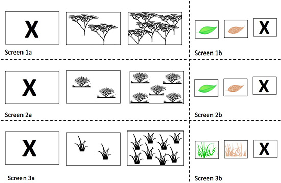
Simple icons displayed by a cell phone app allow African pastoralists to report the condition of vegetation they observe. Tapping an icon can report "no grass," "some grass" or "a lot of grass. Image: Provided." See larger image
Satellite images can distinguish vegetation from arid wastes but can't distinguish between different kinds of vegetation. Goats and camels can browse on shrubbery and tree branches, but sheep and cattle need grass.
Cell phone reports from the pastoralists, tagged with GPS coordinates, are fed to a computer that will learn to associate the reports with the spectral "fingerprints" in visible and infrared light of corresponding locations on the satellite images. Eventually, Gomes says, the computer will be able to identify different kinds of vegetation from the satellite.
In 2010 Cornell and collaborating institutions launched a commercial pilot "index-based livestock insurance" (IBLI) program that repays herders for livestock lost to drought. Statistical modeling based on satellite imagery confirms for insurance companies the rate at which losses occur.
Nathaniel Jensen, a postdoctoral research associate in the Dyson School, tested the crowdsourcing system with a small group of pastoralists in the town of Isiolo in Kenya. Although cell phones are ubiquitous in rural Africa, he gave the herders new phones to ensure that everyone is working on the same platform. Upgrading to a smartphone is part of the appeal of the project for the participants. The observers are paid for their work in cell phone minutes, a common currency in their society.
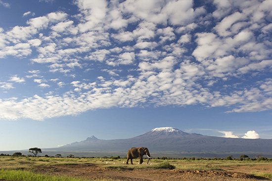
Mount Kilimanjaro in Tanzania. Image: iStockphoto. See larger image
"The app is designed so they don't have to speak the language: it's all pictures," says team member Peter Frazier, assistant professor of operations research and information engineering. By tapping icons, he explains, a user can report what kind of vegetation has been seen, how much is there and how healthy it is. Icons might represent "no grass," "some grass" or "a lot of grass." For a double check, the observer uploads photos. Down the road it might be possible to train a computer to recognize the vegetation seen in the photos, Gomes says.
While it's updating the map, the computer also notes areas where little information is being reported, and adjusts the incentives paid to the pastoralists to encourage them to visit those areas. "Data from near their home is not that interesting," says graduate student Yexiang Xue, who worked on the incentive system. "It turns out to be a very hard problem in optimization. If you set up one place with a very high [payoff], you lose the benefits of people going to other places."
Some of the animals also are fitted with GPS collars to track the movements of the herds. The researchers are watching to see if the IBLI program changes the routes the pastoralists take, and how they respond to incentives. Meanwhile, the data will be given to NGOs and governments to guide the construction of new artificial oases or "water points."
The pilot project was expanded in March, with two Kenyans employed by the International Livestock Research Institute sent out to recruit and train 70 more pastoralists, bringing the total crew to 112. In the last half of March, Jensen reported, the pastoralists uploaded more than 18,000 submissions, roughly 8 per participant per day. "There is soon to be a whole heap of data," he says.